How Geospatial Intelligence Enhances Everyday Life
In ideal world packages arrive precisely where you need them, public services can determine and plan connection points to houses remotely, first responders find your doorstep instantly. But what is behind this simplicity and accuracy? These are civic address points distributed by geospatial data providers, that power safer communities and smarter services.
Beyond emergency moments, civic address points from quietly support the infrastructure of daily life – making city planning more efficient, reducing delivery headaches, and helping governments respond equitably to citizen needs. Their accuracy forms the unseen foundation for connected services we increasingly rely on, from navigation apps to rapid installations of utilities and internet.
What Are Civic Address Points?
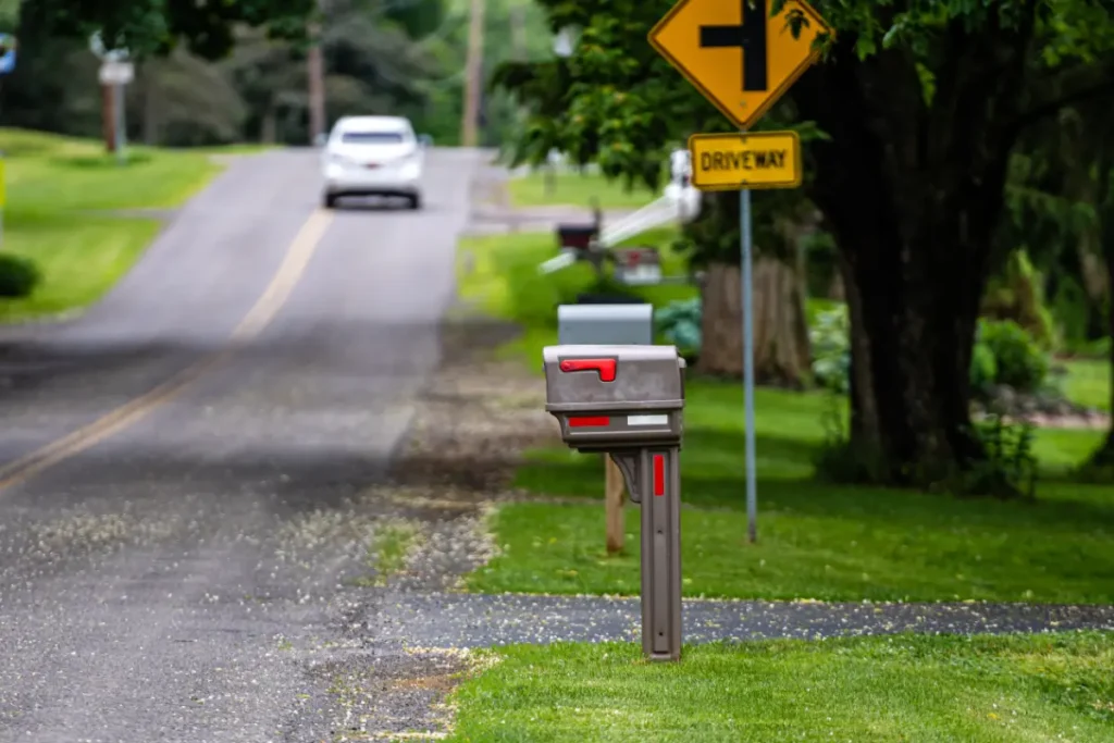
A civic address point is a precise geographic coordinate (like a GPS location) assigned by local municipalities to buildings, entrances, and land parcels. Unlike interpolated or mailing addresses – which estimate location based on street segments or postal routes – civic address points represent real-world, ground-verified locations. Think of them as digital pins marking a building’s exact rooftop or main entrance, not just an estimated spot somewhere along a road.
Municipalities create and maintain these points by conducting surveys, using satellite imagery, and verifying locations with property owners or developers. By doing so, they eliminate ambiguity, reduce duplication, and ensure every home and business – even those in newly built areas or remote places – can be precisely identified by any agency or service provider.
Multiple Civic Address Points for One Property?
A single property can have multiple civic address points, which allows for nuanced, situation-specific navigation, enhancing accuracy for first responders, delivery services, and anyone needing to find a particular location within a larger parcel or building. This structure is particularly important for complex, multi-access, or multi-tenant properties.
Why Would a Property Have Multiple Civic Address Points?
Multiple Entrances:
Properties with several main entrances (e.g., corner buildings, large facilities, schools, shopping centers) may have an address point for each major access point to ensure accurate navigation and emergency response.
Multi-Unit Buildings:
Apartment complexes, condominiums, office towers, or commercial buildings often assign a unique civic address point for each unit, suite, or business within the property, as well as for shared entrances like lobbies.
Complex Parcels:
Large properties containing separate structures (such as a university campus, hospital, or mall) will use address points for each individual building or functional area.
Special Use Cases:
Some industrial, agricultural, or recreational parcels have distinct civic address points for delivery entrances, emergency vehicle access, loading docks, or facility outbuildings.
Why Accuracy of Civic Address Points Matters
Addresses are more than labels – they’re lifelines. Civic address points are manually verified by officials rather than estimated by software, eliminating errors that can occur with synthetic or outdated address data.
Without this accuracy, critical consequences follow:
- Delayed deliveries and misrouted shipments.
- Emergency responders losing precious minutes searching for the right location.
- Mistargeted public services – from utilities to census forms.
Behind every precise address point is a concerted effort to match map data with what’s happening on the ground. Inaccurate information can lead to customer frustration, increased business costs, and even jeopardize lives in emergencies. Accurate civic address points help businesses reach their customers faster, and help governments deploy resources exactly where they’re needed most.
Myth buster: Many believe that postal addresses and civic addresses are the same, but only civic address points guarantee structure-level precision.
Top Uses of Civic Address Points
Civic address points transform how industries and communities operate:
- Emergency Services: Streamlined incident response and dispatch, saving lives and reducing confusion.
- Utilities & Telecom: Efficient installation, customer validation, rapid network expansion, and outage pinpointing.
- Logistics & Delivery: Optimized route planning, accurate drop-offs, and rapid last-mile delivery.
- Real Estate & Insurance: Confident property validation, easier underwriting, and smarter risk assessment.
- Government: Standardized databases, fairer resource allocation, and seamless local service delivery.
Consider the scope: local governments use civic address points to develop smarter city plans; logistics firms depend on them to minimize miles driven; insurance companies use them to validate claims and prevent fraud; and utility companies use them to accurately bill and provide services. The benefits ripple across every sector that relies on knowing exactly where things – and people – are located.
How Clients Use Civic Address Points
Real-world results showcase the value:
- A regional utility mapped 2,000 new homes in a single day, connecting customers faster and more efficiently.
- An emergency services provider reduced response times by 20% after replacing outdated address data.
- A telecom expanded high-speed internet coverage by precisely locating underserved households.
Keeping Address Data Up-to-Date
Static address lists go stale as cities and communities evolve. New developments, road changes, and boundary adjustments occur constantly. Leading providers like Aeroview actively monitor, verify, and update their civic address data, ensuring customers stay ahead of changes, errors, and service disruptions.
Continuous data maintenance involves close collaboration with municipal planning departments, frequent integration of new construction records, and validation with authoritative datasets (like cadastral maps or property tax rolls). This proactive management not only helps providers deliver accurate data, but also gives their clients peace of mind knowing they’re relying on the latest, ground-truthed information.
Choosing the Right Provider
When selecting a civic address point provider, consider:
- Coverage: Are all urban and rural areas included?
- Update Frequency: How quickly are developments reflected?
- Integration: Are formats compatible (Shapefile, KML, APIs) with your systems?
- Accuracy Guarantee: Is the data ground-truthed and municipality-verified?
Established providers like Aeroview offer dedicated support throughout the integration process, provide clear documentation, and stay ahead of evolving geospatial standards. It’s important to partner with a provider that not only supplies accurate data, but also has a strong track record of reliability, industry expertise, and technical support for their clients.
Why Aeroview? Aeroview offers global coverage, frequent updates, multiple integration formats, and rigorous accuracy – minimizing risk and maximizing value for clients across sectors.
FAQs & Common Concerns
- Can I use a civic address for mailing?
No, mailing often relies on postal routes. Civic addresses are for pinpointing physical location. - How is civic address data updated?
Through municipal monitoring, on-the-ground surveys, and integration of new construction data. - What formats are available?
Data is available as Shapefiles, KML, and via API for easy integration.
Civic address point systems may seem unfamiliar at first, but their implementation is often seamless for end users – updates and integrations generally occur in the background, improving accuracy with little to no disruption. If your project or agency has unique requirements, leading providers typically offer custom solutions and ongoing support.
Future Possibilities for Civic Address Points
The potential for civic address points is just beginning to emerge, with a wave of transformative applications on the horizon:
- Smart Cities and IoT: Real-time address updates will enable “living” urban maps, allowing connected devices, utilities, and infrastructure to interact dynamically with their environments. Precise address points will help cities optimize traffic, energy use, and emergency planning with unprecedented accuracy.
- Drone Delivery Revolution: As delivery drones become more common, civic address points will support ultra-precise, property-level landing zones. Unlike traditional street addresses, enhanced geospatial data can pinpoint a package drop-off on a balcony, backyard, or secure smart box, making drone deliveries both faster and safer. Residents could select or update preferred delivery spots, and drones would navigate directly to these points, avoiding obstacles and ensuring secure, timely handoffs—ideal for everything from e-commerce packages to critical medicine.
- Privacy and Data Security Innovations: As mapping technologies grow more powerful, new standards are emerging to keep personal information secure. Future address systems will balance hyper-accurate navigation with privacy controls so individuals and communities remain protected.
Picture an address system that not only finds your home, but understands its features, secures your deliveries via drone, and connects you instantly to the services that matter most—all while keeping your data safe. Civic address points are set to become the foundation of smarter, safer, and more responsive communities for decades to come.
How to Get Started With Civic Address Points
Ready to reimagine your address data? Request a demo, contact our experts, or subscribe to our newsletter for the latest in geospatial intelligence.
Whether you’re in government, logistics, utilities, or real estate, taking the first step towards accurate address data can have an outsized impact on operations, safety, and satisfaction. Let’s make your address work for you – today and tomorrow.