Aeroview’s Civic Address Points provide authoritative, GPS-accurate coordinates assigned by local municipalities to homes, businesses, and land parcels.
Unlike interpolated address ranges or synthetic estimates, our data reflects the real-world location of a verified structure — offering unmatched spatial accuracy for mapping, analytics, and service delivery.
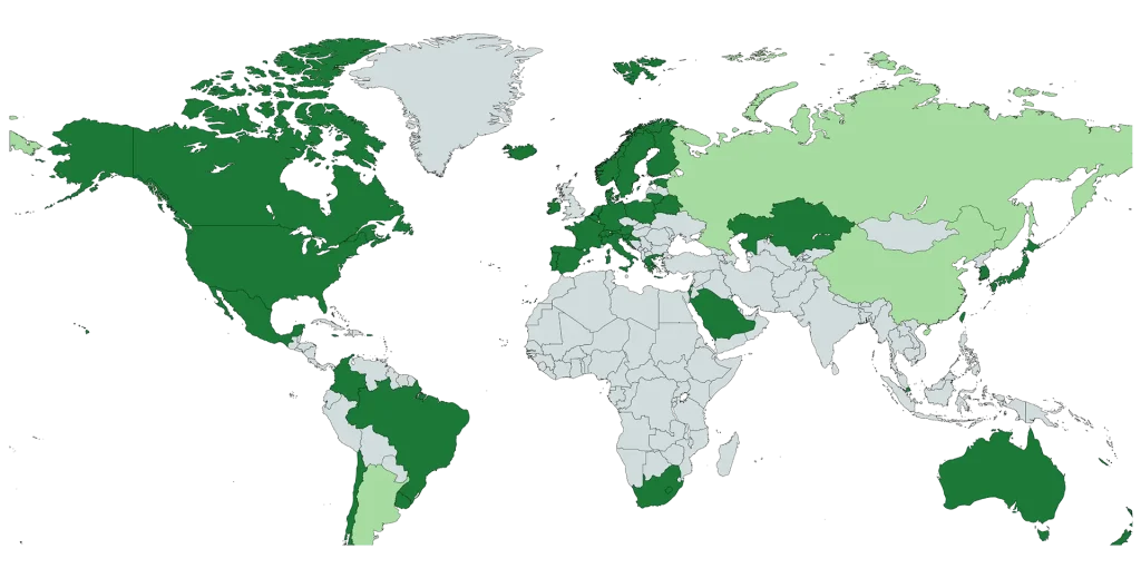
Precise address data for Canada and other key global markets — with expanding availability by region.
Sourced from official municipal and regional government agencies — not estimated or crowd-sourced.
Delivered in GeoJSON, Shapefile, CSV, or via API for seamless integration.
Reflects the latest address changes, new developments, and reassignments.
Flexible options for internal systems, SaaS platforms, or commercial applications.
Civic address points are precise geographic coordinates (X/Y or GPS) assigned to buildings and properties by local municipalities. They mark the actual physical location of an address — typically tied to the structure’s rooftop, entrance, or primary access point.
Unlike interpolated address ranges (which estimate locations based on street segments), civic address points are ground-truthed and verified, making them the most reliable form of address-based spatial data available.
Civic Address maps are used to identify existing and new customers, standardize existing address databases, visualization of location information, geocoding, emergency response, routing, and more.
Our data is available in various formats including Address Points Shapefile and Address Points KML.
Aeroview’s Civic Address Points are foundational to operations across a range of industries:
Our team actively monitors and integrates:
By staying ahead of change, you stay ahead of risk — minimizing data errors, service disruptions, and costly misalignment with ground truth.
Aeroview’s Civic Address Points provide rooftop-level accuracy with GPS-precise coordinates, manually verified by municipal officials rather than estimated through street interpolation. This ensures each point represents the actual physical location of the address, eliminating the estimation errors common with centerline-based geocoding.
Unlike street centerline geocoding that interpolates approximate locations based on address ranges, Civic Address Points pinpoint exact building locations. Street interpolation can place street addresses incorrectly when buildings or unit number don’t follow linear patterns, while address points provide the precise rooftop location, critical for emergency response and delivery accuracy.
Rooftop accuracy represents the exact geographic location of a building, while interpolated addresses estimate location along a street segment based on address ranges. Rooftop accuracy is the gold standard for geocoding, providing precise coordinates that eliminate the guesswork of interpolation.
Civic Address Points provide nationwide coverage with both urban and rural address locations. The dataset contains addresses, civic address data, from authoritative municipal sources representing all provinces and territories.
Yes, the dataset includes comprehensive rural coverage alongside urban addresses across Canada. Rural civic addresses are particularly important for emergency 911 services where precise location identification is critical.
Coverage comprehensiveness varies by province depending on municipal data availability and addressing programs. The dataset aggregates addresses from authoritative provincial, territorial, and municipal government sources to provide the most complete representation available.
Address point datasets typically receive regular updates ranging from daily to quarterly depending on the source. Aeroview provides monthly updates to ensure customers have access to the latest civic address assignments and changes.
New addresses are captured when municipalities assign civic numbers to new developments, buildings, or structures. Municipal officials digitize and verify these addresses in their authoritative addressing systems, which are then aggregated into the national dataset.
Civic Address Points are typically available in multiple GIS-compatible formats including Shapefile, File Geodatabase, CSV, GeoJSON, KML, and REST services. These formats ensure compatibility with major GIS platforms and spatial analysis tools.
Each address point includes civic number and suffix, street name and type, community name, municipality, province, postal code (where applicable), unique civic identifier, latitude and longitude coordinates, and additional metadata such as building use codes.
Yes, Civic Address Points are designed for seamless integration with GIS platforms including ArcGIS, QGIS, and web mapping applications. The standardized formats and coordinate systems ensure compatibility with enterprise GIS workflows and address validation systems.
Licensing options vary based on usage requirements. We can offer different licensing tiers based on deployment scale and use cases.
Yes, depending on the license type, address points can be used for commercial applications including logistics optimization, delivery routing, civic address finder, postal service, site selection, emergency dispatch, customer analytics, and geocoding services.
Insights. Updates. Location Intelligence — Delivered.
Join our newsletter or follow us on social media to get the latest on geospatial trends, product updates, and practical use cases. We’re building a community of professionals who care about precision, data quality, and smart location-based solutions.
Subscribe today and stay ahead in the world of mapping and spatial data.
Stay informed about our latest geospatial services and updates. Join our newsletter for insights tailored to your needs.
By clicking Subscribe, you agree to our Terms and Conditions.