Have questions?
Browse our responses below, or contact us for detailed information and customized solutions
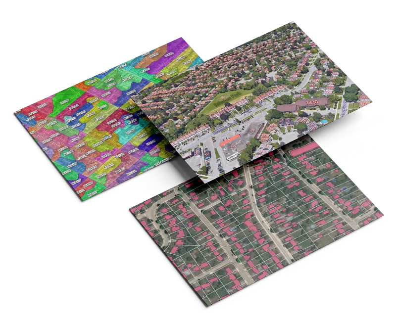
Access postal boundaries across Canada, the U.S., and multiple international regions in one unified dataset.
Each polygon is sourced and validated using authoritative national and municipal data for unmatched precision.
Available via API, WMTS, or downloadable formats including GeoJSON, Shapefile, and CSV.
Stay current with quarterly updates that reflect new codes, boundary changes, and urban developments.
Transparent, scalable licensing terms with no hidden restrictions — built for enterprise use.
Geospatial data links real-world activities to precise locations. As technology becomes more accessible, organizations across industries are recognizing how geographic context enhances decision-making. Whether it’s optimizing customer outreach, tracking service coverage, or improving internal analytics, spatial insight helps identify opportunities, reduce costs, and improve outcomes.
Our clients use Aeroview’s data in a wide variety of ways:
Absolutely. We love open data and encourage its use where available. It’s a great starting point for many organizations. However, Aeroview goes further — offering enriched, cleaned, and extended datasets that often exceed the scope, coverage, and update frequency of open data.
Not at all. We offer scalable solutions tailored to your budget and timing. Reach out — we’ll find a package that fits.
Our address data is sourced directly from municipal governments and updated quarterly. We track real-world changes like renumbering, amalgamations, and new developments — giving you the most accurate, real-world representation available.
We provide quarterly updates to our postal polygon datasets using verified national and local sources, so you always have the most current and accurate boundary data.
Each Civic Address Point is a verified GPS location tied to a real building or property — ideal for geocoding, delivery, emergency response, and infrastructure planning.
We offer comprehensive coverage across:
Datasets include address points, postal boundaries, POIs, and administrative boundaries.
Yes. Our secure, scalable API provides real-time access to:
Perfect for integration into maps, apps, CRMs, or analytics tools.
We deliver data in industry-standard formats, including:
Access is typically granted within 1 business day. API and WMTS users receive instant credentials and setup documentation.
Of course. We offer free data samples on request so you can evaluate structure, compatibility, and accuracy.
You get direct access to our in-house geospatial experts for onboarding, technical integration, and ongoing support — no offshore call centers or slow ticket queues.
Yes. We specialize in tailoring datasets to your:
If you have a custom need, we’ll build a solution to match.
Yes. Our licensing is flexible and transparent, designed for:
Let us know your use case and we’ll match it to the right license.
We deliver data in industry-standard formats, including:

Insights. Updates. Location Intelligence — Delivered.
Join our newsletter or follow us on social media to get the latest on geospatial trends, product updates, and practical use cases. We’re building a community of professionals who care about precision, data quality, and smart location-based solutions.
Subscribe today and stay ahead in the world of mapping and spatial data.
Stay informed about our latest geospatial services and updates. Join our newsletter for insights tailored to your needs.
By clicking Subscribe, you agree to our Terms and Conditions.