In property insurance, a record is only as useful as its location. Underwriters, catastrophe modelers, and risk teams may start with an address, but what they actually need is confidence in where that risk truly sits on the ground.
Insurance decisions are increasingly spatial. Hazard layers, catastrophe models, underwriting rules, and portfolio analysis all depend on location-specific inputs. When those inputs are off, even by a modest distance, the downstream view of risk can be distorted.
Rooftop-accurate address points for insurance teams are a reliable foundation for risk modeling, pricing, and portfolio management by reducing one of the most avoidable sources of model uncertainty: where the building actually is.
What rooftop-accurate address points are in insurance workflows
An address point is a geospatial record that links a real-world address to precise coordinates. Done well, it represents the actual location of a building, entrance, or insured site rather than a rough estimate along a street segment.
In insurance workflows, address points are the bridge between written address data and the latitude/longitude coordinates that models and GIS systems require. That point becomes the key for joining hazard layers, building attributes, historical losses, and external data in downstream analytics.
Milliman and other industry advisors emphasize that spatial resolution changes the quality of property risk pricing, especially for localized perils such as flood and wildfire. When the insured structure’s exact location matters, parcel centroids or generalized geocodes are often not accurate enough for those decisions.
Vendors such as Aeroview provide rooftop-precision, verified address data across national and global coverage areas, with regular refresh cycles and clear data lineage so that carriers can understand and trust the positional accuracy of each location record.
Why small location errors distort insurance risk assessment
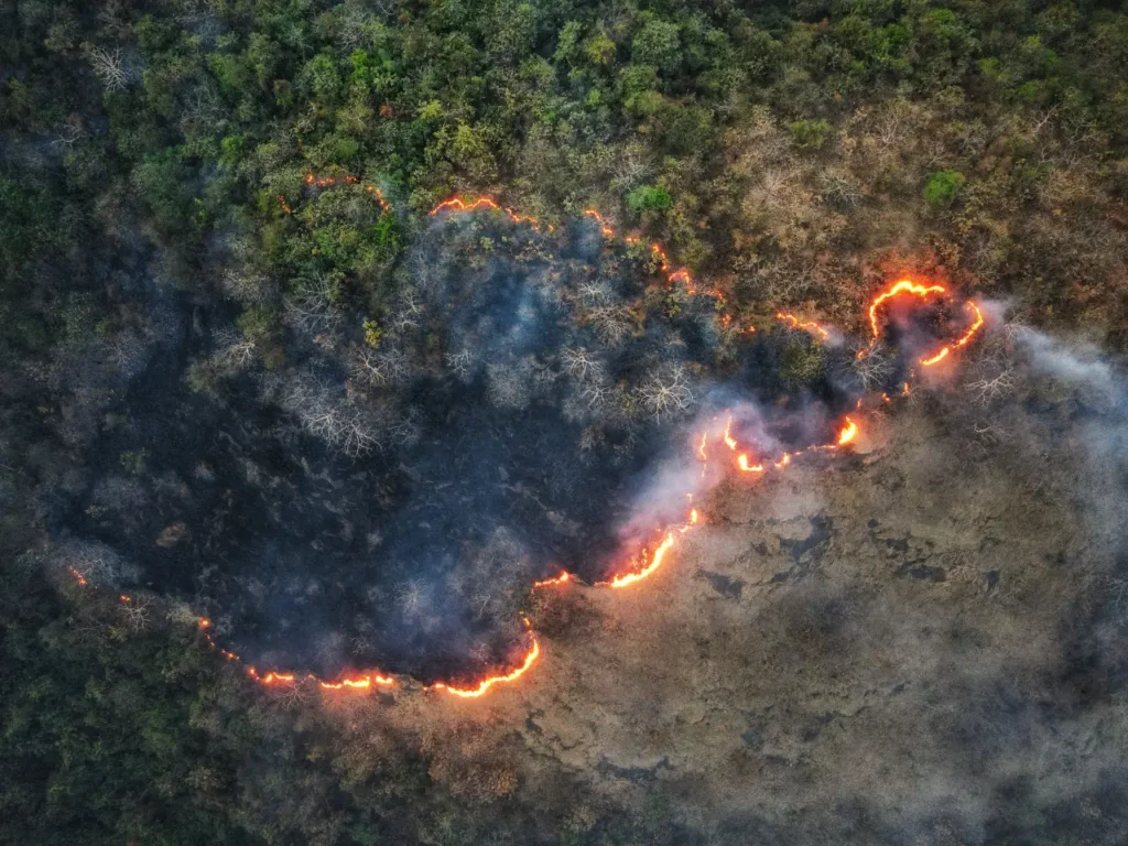
In many catastrophe models and hazard datasets, risk changes quickly over short distances. A few tens of meters can be the difference between being inside or outside a regulatory floodplain, a wildfire-urban interface, or a wind-borne debris corridor.
If a policy is geocoded to a street centroid that falls just outside a designated hazard zone, modeled loss estimates, required reinsurance, and pricing signals may all be biased low. Equally, imprecise geocoding can overstate risk for relatively safe properties, hurting growth and retention.
Accurate address points reduce this positional noise so that hazard, exposure, and vulnerability are all evaluated against the right place in the real world. At portfolio scale, thousands of small misplacements can distort views of aggregate exposure near rivers, coastlines, or wildland-urban interfaces, weakening capital allocation and regulatory reporting.
Address points for insurance underwriting and property-level screening
Underwriting depends on screening the right property against the right conditions. If the location is off, a property may be assigned to the wrong hazard zone, evaluated against the wrong exposure profile, or flagged incorrectly during risk review.
Underwriters increasingly rely on automated location intelligence in their workbench: distance to coastline, nearest river segment, wildfire fuel density, slope and elevation, crime indices, and proximity to fire services. All of these signals are only as good as the address point used to query them.
With high-confidence address points, underwriters can calculate exact offsets to hazard features and infrastructure – for example, whether a dwelling is 40 meters or 400 meters from a riverbank, or on which side of a levee or firebreak it sits. This makes it easier to enforce underwriting guidelines, flag borderline risks for referral, and document decisions for regulators and reinsurers.
Precise address points also support property-level screening in digital quote journeys. Instead of asking applicants to self-declare nuanced hazards, carriers can pre-fill defensible risk scores from geospatial inputs, reducing friction while keeping control of the risk selection logic.
Address points for exposure analysis and catastrophe modeling
Catastrophe models are only as strong as the exposure data that feeds them. Supervisors such as the NAIC highlight that exposure modules depend on location-specific information – property addresses or coordinates, risk characteristics, and insured values – and that model uncertainty increases when input data is inaccurate or incomplete.
Address-point-based geocoding allows portfolios to be assigned to the correct geography and aggregated at much finer spatial resolutions without relying on coarse zonal assumptions. Analysts can see which buildings actually fall behind a specific flood defence, sit on a particular slope aspect, or share a roofline with neighboring risks.
When exposure is represented by rooftop-accurate address points and, where available, building footprints, models can assign peril intensities and secondary modifiers much more precisely. For flood, that includes depth and flow velocity at the actual structure; for wind, terrain roughness and shielding; for wildfire, distance to fuels and ember exposure.
Accurate address points also make it feasible to combine vendor catastrophe models with bespoke or open-source hazard layers, because all datasets share a consistent spatial reference. This supports richer what-if analysis, climate-scenario testing, and regulatory stress-testing.
Address points for hazard assessment and pre-bind property screening
Hazard assessment often happens before a policy is quoted, renewed, or escalated for review. At that stage, location quality has a direct impact on speed and consistency in underwriting operations.
When address data is coarse, insurers may need more manual review, more exception handling, and more conservative assumptions. When address data is stronger, screening can happen closer to the actual property, improving checks for flood, wildfire, proximity-based hazards, and other localized conditions.
This is one reason accurate address points are valuable beyond catastrophe modeling. They improve day-to-day operational screening, not just advanced analytics. Industry guidance is clear that different insurance use cases require different levels of spatial resolution, and that localized perils often require more precise location data.
Address points for portfolio accumulation and capital planning
Capital and risk teams routinely run accumulation studies: how much total insured value lies within a given distance of a coastline, fault line, or industrial facility; how much exposure sits within specified urban grids; where the portfolio is most sensitive to a given peril.
If underlying locations are only known at postal-code or municipality level, accumulation calculations can be off in both directions – overstating exposure in some cells, understating it in others. Better address points tighten these estimates, so that capital is deployed against the actual distribution of risk rather than an approximation.
This is particularly important as regulators and rating agencies focus more closely on how climate and catastrophe risks are quantified. Transparent, high-accuracy geocoding gives insurers a stronger evidentiary basis for their internal models, ORSA disclosures, and reinsurance negotiations.
Address points for claims, event response, and insurance operations
The value of accurate location data does not end at underwriting. Claims teams also benefit when a property is pinned to the correct point on the map.
After severe weather or another major event, location accuracy helps carriers identify affected properties faster, prioritize response, and support cleaner triage. It also helps validate whether a reported loss aligns with the event footprint and the property’s actual location.
Rooftop-accurate address points reduce false positives and false negatives when overlaying event footprints or remote-sensing damage maps on the in-force portfolio. Adjusters can be routed to the right structure – not just the rough area – and event-level dashboards can more accurately show how many policies are likely total losses, partial losses, or unaffected.
From an analytics perspective, having consistent, verified coordinates on every historical claim supports more robust model calibration and fraud detection. Clusters of suspicious claims, inconsistencies between reported damage and hazard intensity at the address, or repeated small claims in the same micro-area become easier to detect when each location is confidently pinned to the map.
Address data governance, model risk, and regulatory expectations
Model risk management frameworks increasingly require insurers to demonstrate control over key input data, including location. Address points with documented provenance, confidence scores, and change history help satisfy these expectations.
Rather than relying on a black-box geocoder, carriers can adopt a curated address-point layer as a single source of truth across underwriting, pricing, exposure management, and claims. This reduces reconciliation work between systems and supports consistent risk views across the organization.
When auditors, regulators, or reinsurers ask why a given risk received a particular price or capital charge, teams can trace the decision back through the location input, the hazard values at that coordinate, and the model logic applied – a level of transparency that is difficult to achieve with less precise or undocumented geocoding.
How Aeroview address points support insurance and risk teams
Aeroview provides verified rooftop address points and postal code polygons designed for mission-critical applications such as insurance risk modeling, digital mapping, and AI-driven analytics. Global coverage with continuous refresh cycles means that new developments, renumbered streets, and boundary changes are captured before they show up as surprises in loss experience.
Each address point is derived from authoritative civic address sources wherever available and supplemented with advanced geospatial techniques, remote sensing, and rigorous QA. Records include geospatial coordinates, normalized address strings, administrative context, and confidence metrics, making it straightforward to plug them into underwriting workbenches, catastrophe-model exposure files, or in-house risk engines.
For carriers that need more than static files, Aeroview’s APIs expose address verification, geocoding, and postal lookup functions that can be embedded in agent tools, customer portals, and data pipelines. This allows insurance and risk teams to standardize on a single, high-confidence location backbone while tailoring how and where it is consumed across underwriting, exposure management, and claims workflows.