Executive Summary: High-quality address point data is foundational for enterprise GIS, routing, and analytics. Poor data quality undermines operations and risks compliance. This article explains how to measure and ensure address point data quality. We cover accuracy metrics (meters of error, rooftop vs street placement, unit-level precision), completeness metrics (coverage of all units, multi-occupancy buildings), and validation methods (field checks, imagery, authoritative cross-checks, crowdsourcing). We also discuss update practices, automated QA workflows, data standards (e.g. UPRN, ISO 19160, INSPIRE, NENA), and the operational costs of errors. International examples (OS AddressBase, UK UPRN, US NAD/TIGER, OpenStreetMap) illustrate these points. A comparison table and validation flowchart guide decision-makers, and we conclude with a checklist of best practices for enterprise address data governance.
What Is Address Point Data Quality?
Address point data refers to geocoded records of individual addresses (often “civic” addresses). Data quality for address points has two dimensions:
- Positional Accuracy: How close the recorded coordinates are to the actual location (e.g. building centroid or entrance).
- Completeness: Whether all real-world address units are included (e.g. every apartment, unit, or building).
High-quality address point data ensures that every valid address has a point in the dataset, placed as accurately as possible. This supports reliable geocoding, precise routing, and correct analyses. Low-quality data leads to misrouted vehicles, failed services, and compliance headaches.
Accuracy Metrics
Positional accuracy measures how far an address point is from its true location. Key metrics include:
- Centroid vs Rooftop: Many datasets place points at building centroids or doorways (rooftops) for best accuracy. For example, the Oregon standard ranks “unit level (best), rooftop/building (good), parcel centroid (fair), street interpolation (estimated)”. At minimum, a point should lie within the building footprint; anything placed on the street centerline is a coarse estimate.
- Mean Error Distance: Often reported in meters (e.g., “average error <5m” for rooftop placement).
- Unit-Level Precision: In multi-unit buildings, best practices place points on each unit entrance. A point in a single-family home is “best” (unit), whereas group placement on one point is “fair.” The Oregon schema calls sub-address (unit) level “best” accuracy.
- Accuracy Flags: Some address datasets include an accuracy code per point (for example, Precisely’s Address Fabric uses “location accuracy codes” to describe confidence). Geocoding results often carry a status (e.g. “rooftop match” vs “approximate street match”).
- Matching Method: Geocoders often do multi-pass matching: first try precise rooftop-level, then parcel centroid, then street interpolation. Each method has inherently different accuracy.
According to Ordnance Survey, their AddressBase Core provides “complete, accurate address data” (implying high positional accuracy). In contrast, open/crowdsourced sources may have mixed accuracy, and street interpolation is lowest quality. Enterprises should quantify accuracy by comparing address points against high-resolution references (e.g. building footprint data or surveyed coordinates).
Completeness Metrics
Completeness refers to coverage of real-world addresses.
Key aspects:
- Coverage: The proportion of valid addresses included in the data. An authoritative national address file (e.g. OS AddressBase, US NAD) aims for ~100% coverage of deliverable addresses. Open data often has gaps: OSM may be 80–90% complete in some urban areas but much lower in others.
- Unit Completeness: Multi-occupancy buildings (apartments, offices) require separate points for each unit. Missing unit addresses (or merging them under one point) is an error.
- Multi-Unit Handling: Best practice is to create a “child” point for each apartment/suite with a unique ID. Missing these can significantly undercount addresses.
- Attribute Completeness: Address point records typically include fields like house number, street, postal code. Completeness also means none of these key fields are blank.
- Spatial Completeness: All geographic variations (rural routes, buildings without mail, shelters) should be represented if relevant to use-cases.
Enterprises should measure completeness by comparing against authoritative lists (e.g. property registries, postal delivery databases) or by auditing a sample area. For example, OS AddressBase Core claims “complete, accurate address data” across Great Britain. In practice, many national address datasets are near 100% coverage for standard addresses, whereas volunteer-based datasets may omit uncommon addresses.
Validation Methods
Ensuring address point quality requires both automated checks and manual validation:
- Ground Truth Surveys: Field teams physically verify addresses. This is resource-intensive but definitive, often used for critical applications (like emergency dispatch systems).
- Parcel/Property Matching: Match address points to cadastral parcels or building footprints. Each address point should lie within the correct property polygon. Discrepancies can indicate misplacement. Some standards require moving a point from street to parcel if no building is present.
- Aerial/Satellite Imagery: Overlay address points on high-res imagery to confirm placement on roofs or doorways. Tools like GIS can highlight outliers (points far from structures).
- Delivery Verification: For some sectors, sending test mail or verifying deliveries (e.g. confirming service availability) can validate an address’s existence and location.
- Crowdsourcing & Reporting: User feedback or crowd data (e.g. Google’s Local Guides, OpenStreetMap edits) can flag missing or wrong points for correction.
- Cross-Dataset Comparison: Reconcile address points against alternative sources. For example, if an address exists in one dataset but not another, this signals a gap. Multi-source matching (fuzzy string match + spatial join) helps identify missing units or mislabeled roads.
These methods are often combined. For instance, an initial spatial join might flag points outside parcels or far from any road, then those flagged points undergo manual review.
Update Cadence and Maintenance
Address data changes continually (new constructions, renamings, subdivisions). Maintain quality by:
- Regular Updates: Authoritative datasets are updated on set schedules (monthly, quarterly, or continuously via local gov feeds). Enterprises should track update frequency and plan periodic data refresh.
- Change Tracking: Use data with “lifecycle” fields (construction status, occupied/vacant flags). Some products (OS AddressBase Premium) explicitly include life-cycle updates.
- Maintenance Workflows: Have clear processes for applying updates: ingest new files, reconcile changes, and re-run QA.
- Correction Mechanisms: Enable users or custodians to report errors. National systems often allow submissions (e.g. via local gazetteers in the UK).
Without disciplined maintenance, even an initially high-quality address point dataset degrades quickly.
Automated QA Workflows and Tools
Many enterprises use automated tools to enforce quality before and after data integration. Common techniques include:
- Fuzzy Matching: Apply string similarity checks between address attributes (street name, city) against reference lists to catch typos or formatting issues.
- Spatial Joins: Check if points fall on valid geometry (road centerlines, parcel footprints). Points off all features get flagged.
- Rule-based Validation: Enforce address rules (e.g. street number within known range, valid postal code).
- Probabilistic Matching: Algorithms (e.g. for customer data) that consider partial matches or alternate formats, balancing multiple fields to verify address uniqueness.
- Deduplication: Identify and merge duplicate address points (sometimes two data sources or errors create duplicates).
- Quality Flags: Maintain status fields (e.g. Verified, Estimated) and filter by them in outputs. Accuracy codes (like those in Address Fabric) help track which points are rooftop-level vs interpolated.
Software platforms (Esri Data Reviewer, Safe Software FME, or custom scripts) can automate these checks. For example, one workflow might: ingest new address points → spatially join to building footprints → mark mismatches → verify against postal data → flag failures for QA.
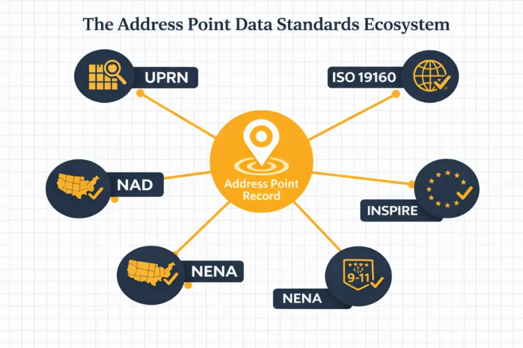
Standards and Identifiers
Compliance with standards strengthens quality:
- ISO 19160-3: The international standard for address data quality, ISO 19160-3:2020 “establishes a set of data quality elements and measures for describing the quality of address data”. It provides a framework (but no fixed thresholds) for evaluating completeness, accuracy, consistency, and more.
- INSPIRE – Addresses (EU): European Directive requires harmonized address data (ANNEX I). Member states maintain address point layers with standard schemas.
- Unique Identifiers (UPRN): The UK’s UPRN (Unique Property Reference Number) is a persistent ID for every addressable location. It enables linking and tracking addresses across systems, improving consistency and deduplication. Many countries have similar IDs (e.g. Australia’s G‑NAF).
- NENA GIS Data Model (US): For 9‑1‑1, NENA’s standard demands high address accuracy. The NG9-1-1 standard (APCO/NENA) includes requirements for verified civic and location data.
- National Address Databases: Some countries (US National Address Database, Canada’s future Address Registry) provide authoritative address points for public use, with clear quality expectations.
Using such standards (e.g. always storing UPRN with each point) facilitates data integration and quality assurance.
Operational Risks of Poor Quality
Underestimating address point quality has serious consequences:
- Routing Failures: A misplaced address can send delivery or field services off-route, increasing time/cost. Emergency vehicles rely on precise points for life-critical response.
- Compliance Issues: In regulated industries (e.g. utilities, healthcare), having certified location data is often required. Poor quality can violate regulations or audit standards.
- Customer Experience: Failed deliveries or misrouted services due to bad data lead to customer dissatisfaction and reputational damage.
- Liability: In public safety (e.g. 9-1-1), an incorrect address could delay help. In business (insurance), using outdated address data may lead to incorrect risk modeling.
- Inefficiency: Time and resources are wasted manually fixing bad data. The total cost of ownership (TCO) rises if quality assurance is not built in.
Enterprises must view address data quality as risk management. Investing in validation pays off by avoiding these high-cost errors.
Cost vs Quality Trade-Off
Maintaining high address point quality has costs (data purchases, processing, audits), but the risk of low quality is typically much higher. Consider:
| Approach | Licensing/Acquisition Cost | Quality Risk |
| Authoritative Data | High (paid license/subscription) | Low (rigorous QA, official sources) |
| Crowdsourced/Open Data | Low/None (free) | Higher (incomplete coverage, uncertain accuracy) |
High-quality licensed data incurs upfront fees but often reduces downstream waste. Free/open data lowers initial spend but may require heavy validation or lead to costly mistakes.
Comparison of Address Data Types
| Data Source | Typical Accuracy | Typical Completeness | Update Frequency | Best Use Cases |
| Authoritative Address File (e.g. OS AddressBase, US NAD) | >5m (building or unit level) | Very high (approaching 100%) | Regular (monthly/quarterly by agencies) | Emergency services, logistics, compliance |
| Open/Crowdsourced Data (e.g. OpenStreetMap) | Variable (often street level; any rooftop matches are community-contributed) | Uneven (urban areas good; rural often sparse) | Irregular (community-driven updates) | Prototyping, base mapping, analysis in gaps |
| Geocoding Interpolation (e.g. Google, USPS TIGER) | Coarse (street midpoint, often 30–100m error) | Depends on address point database; often incomplete for non-postal addresses | Dynamic (API responses, but base data updated infrequently) | Broad analytics, non-critical routing, initial geocoding |
Recommendations & Checklist
To achieve high-quality address point data, enterprises should:
- Define Quality Requirements: Specify needed accuracy (e.g. <10m) and completeness (e.g. include all apartment units).
- Pilot and Measure: Test candidate datasets against a truth set. Calculate error distances and match rates.
- Use Standards: Incorporate unique IDs (UPRN, etc.) and follow ISO/INSPIRE models to ensure consistency.
- Automate QA: Set up workflows with fuzzy matching, spatial joins (point-in-polygon), and completeness checks. Flag issues automatically.
- Validate Regularly: Schedule periodic re-validation. Even “static” address files can grow stale.
- Combine Approaches: Consider a hybrid strategy (e.g. authoritative base with open augmentation) but always track provenance.
- Track and Audit: Maintain logs of data provenance, QC results, and version changes.
- Procurement Checklist:
- Verify data licensing allows your use case.
- Check update frequency and delivery process.
- Ensure vendor or source provides metadata on accuracy/completeness.
- Look for quality certifications (e.g. ISO 19160 compliance, NENA conformance).
Practical Tip: Wherever possible, choose address datasets that include built-in quality attributes (accuracy codes, verification flags) and support global standards. This makes automated validation and integration far simpler.
Overall, address point data quality is a critical operational asset. Enterprises that invest in rigorous validation, adherence to standards, and robust QA workflows will reap reliability and efficiency gains. Poor quality, by contrast, can cripple critical systems. Armed with this knowledge, technical leaders can make informed decisions about sourcing and validating address point data to meet enterprise needs.
At Aeroview Technologies, we provide authoritative geospatial data built to enterprise quality standards — so your teams can route, analyze, and operate with confidence. If you’re evaluating your current address data, building a validation workflow, or sourcing civic address points for a new region, we can help you get it right from the start. Talk to our team at aeroview.ca to learn how authoritative address point data can reduce risk and improve reliability across your operations.